Unlocking the Potential: A Comprehensive Guide to Drone Surveying and Mapping
Drones have revolutionized the way we approach surveying and mapping, unlocking a world of possibilities and efficiency. In this comprehensive guide, we will take you on a journey to discover the potential of drone surveying and mapping and how it can benefit various industries. From construction sites to agricultural landscapes, drones offer a bird’s-eye view like no other, capturing high-resolution aerial imagery and generating precise 3D maps. This technology allows businesses to save time and resources while gaining valuable insights into their projects.
Equipped with advanced sensors and cameras, drones can collect vast amounts of data with remarkable accuracy. From topographic mapping to infrastructure inspection, they provide a cost-effective and time-efficient solution, reducing the need for manual labor and ensuring worker safety in hazardous environments. Whether you are a surveyor, engineer, or simply curious about the capabilities of drone surveying and mapping, this guide will equip you with the knowledge to harness this powerful tool effectively. Get ready to unlock the potential and soar to new heights in your industry.
Advantages of using drones for surveying and mapping
Drones offer numerous advantages when it comes to surveying and mapping. The first and most obvious advantage is their ability to capture high-resolution aerial imagery. With their advanced sensors and cameras, drones can capture detailed images from a bird’s-eye view, providing a level of detail that was previously unattainable. This allows businesses to gain valuable insights into their projects, leading to better decision-making and improved efficiency.
Another advantage of using drones for surveying and mapping is the cost-effectiveness and time efficiency they offer. Traditionally, surveying and mapping required manual labor and extensive resources, which could be time-consuming and expensive. Drones, on the other hand, can cover large areas in a fraction of the time, reducing the need for manual labor and saving businesses valuable resources. This not only saves time and money but also reduces the risk of errors and inaccuracies.
Furthermore, drones provide a safer alternative for surveying and mapping in hazardous environments. In industries such as construction and infrastructure inspection, workers often have to operate in dangerous conditions. By utilizing drones, businesses can minimize the risk to their employees by conducting surveys and inspections remotely. This not only improves worker safety but also allows for more thorough and accurate data collection.
Overall, the advantages of using drones for surveying and mapping are clear. They offer high-resolution imagery, cost-effectiveness, time efficiency, and improved worker safety, making them an invaluable tool for various industries.
Drone surveying and mapping applications
The applications of drone surveying and mapping are vast and varied. Let’s explore some of the key industries that have benefited from this technology.
1. Construction: Drones have become an essential tool in the construction industry, providing valuable data for site planning, progress monitoring, and quality control. They can capture detailed images of construction sites, generate accurate 3D models, and even perform thermal inspections to identify potential issues. By using drones, construction companies can streamline their operations, reduce costs, and ensure projects are completed on time and within budget.
2. Agriculture: Drones have revolutionized the way farmers manage their crops and optimize their yields. With aerial imagery and sensor technology, drones can monitor crop health, identify areas of stress or disease, and even assist in precision agriculture practices such as targeted spraying or irrigation. By providing farmers with real-time data, drones enable them to make informed decisions and maximize their productivity.
3. Mining: In the mining industry, drones have proven to be a valuable asset for surveying and mapping vast areas of land. They can quickly and accurately capture data on topography, stockpiles, and infrastructure, allowing mining companies to monitor their operations, plan for future development, and ensure compliance with regulations. Drones also help improve safety by reducing the need for manual inspections in hazardous areas.
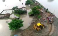
4. Environmental monitoring: Drones play a crucial role in environmental monitoring and conservation efforts. They can be used to survey and map ecosystems, monitor wildlife populations, track changes in land use, and assess the impact of human activities on the environment. By collecting data from above, drones provide researchers and conservationists with a comprehensive view of the landscape, enabling them to make informed decisions and take proactive measures to protect our planet.
These are just a few examples of the diverse applications of drone surveying and mapping. From construction to agriculture, mining to environmental monitoring, drones have proven to be a versatile and invaluable tool for various industries.
Regulations and legal considerations
While drones offer incredible potential for surveying and mapping, it is essential to understand and comply with the regulations and legal considerations surrounding their use. Failure to do so can result in fines, legal consequences, and reputational damage. Let’s explore some of the key regulations and legal considerations that businesses and individuals should be aware of.
1. Registration and licensing: In many countries, drones over a certain weight threshold need to be registered with the appropriate aviation authority. Additionally, operators may be required to obtain a license or certification to operate drones for commercial purposes. It is essential to research and comply with the specific requirements in your jurisdiction to ensure legal operation.
2. Flight restrictions: There are certain areas where drone flights are restricted or prohibited, such as airports, military installations, and national parks. It is crucial to familiarize yourself with these restrictions and plan your drone missions accordingly. Ignoring flight restrictions can not only lead to legal consequences but also pose a risk to public safety.
3. Privacy concerns: Drones equipped with cameras raise privacy concerns, and it is important to respect the privacy rights of individuals. Avoid flying over private property without permission and be mindful of capturing images or videos that may infringe on someone’s privacy. It is advisable to consult legal experts to ensure compliance with privacy laws and regulations.
4. Insurance and liability: Accidents can happen, and it is important to have appropriate insurance coverage to protect yourself and your business. Drones can cause property damage or injury, and it is crucial to have liability insurance that covers potential risks. Consult with insurance providers to understand the specific coverage needed for drone operations.
By understanding and adhering to the regulations and legal considerations, businesses and individuals can operate drones for surveying and mapping responsibly and legally.
Essential equipment for drone surveying and mapping
To effectively utilize drones for surveying and mapping, it is essential to have the right equipment. Let’s explore the key components that make up a comprehensive drone surveying and mapping setup.
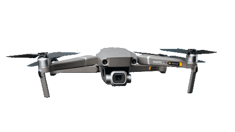
1. Drone: The first and most obvious piece of equipment is the drone itself. When choosing a drone for surveying and mapping, consider factors such as flight time, payload capacity, camera quality, and stability. It is important to select a drone that suits your specific needs and requirements.
2. Camera and sensors: Drones used for surveying and mapping often come equipped with specialized cameras and sensors. These cameras capture high-resolution imagery, while sensors such as LiDAR or thermal sensors provide additional data for more detailed analysis. Consider the specific requirements of your projects and choose cameras and sensors that will provide the necessary data for accurate mapping and analysis.
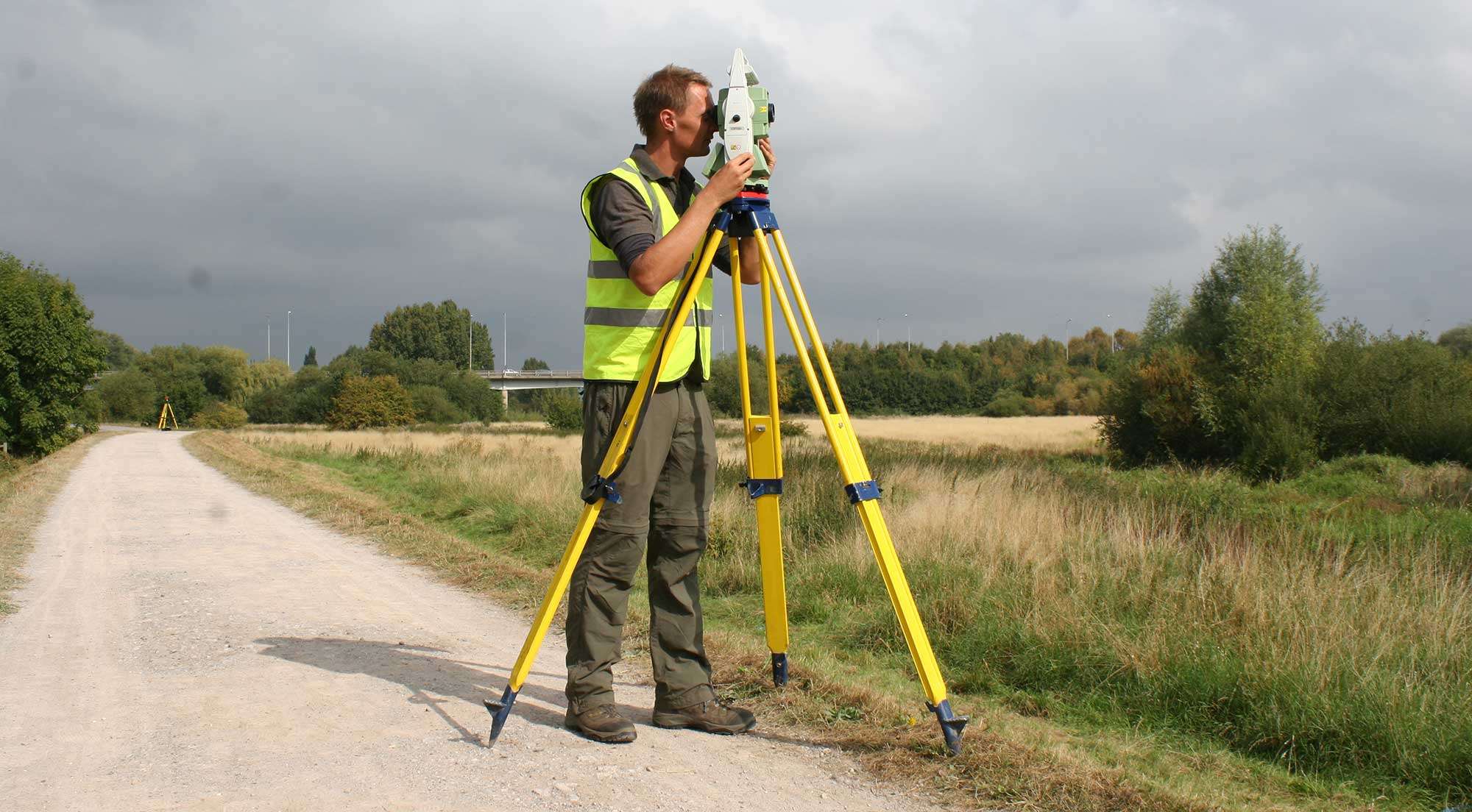
3. Ground control points (GCPs): GCPs are markers placed on the ground with known coordinates. They are used as reference points to improve the accuracy of the drone’s mapping data. GCPs can be physical markers or targets visible to the drone’s camera. It is also important to strategically place GCPs to ensure optimal accuracy in your mapping projects.
4. Software and processing tools: To process and analyze the data captured by the drone, specialized software and processing tools are required. These tools allow you to stitch together aerial images, generate 3D models, and extract valuable insights from the data. Some popular software options include Pix4D, DroneDeploy, and Agisoft Metashape. Research and select the software that best suits your needs and budget.
5. Accessories and safety equipment: In addition to the essential components, there are various accessories and safety equipment that can enhance your drone surveying and mapping setup. These may include spare batteries, additional memory cards, propeller guards, and carrying cases. It is important to have the necessary accessories to ensure the smooth operation of your drone and to protect it during transportation.
By investing in the right equipment and accessories, you can ensure the success of your drone surveying and mapping projects.
Planning a drone surveying and mapping mission
Planning is a crucial step in conducting a successful drone surveying and mapping mission. A well-planned mission ensures efficient data collection, accurate mapping, and the safety of the operation. Let’s explore the key steps involved in planning a drone surveying and mapping mission.
1. Define the objectives: Start by clearly defining the objectives of your surveying and mapping mission. What specific data do you need to collect? What insights are you looking to gain? By clearly defining your objectives, you can tailor your mission to meet those specific goals.
2. Select the appropriate flight plan: Depending on your objectives, you will need to select the appropriate flight plan for your drone. There are various types of flight plans, including grid, circular, and waypoint missions. Consider factors such as the area to be covered, the desired resolution of the images, and any specific flight restrictions or obstacles.
3. Conduct a site survey: Before launching your drone, conduct a site survey to identify any potential obstacles or hazards. Look out for trees, buildings, power lines, or other structures that may interfere with the flight path. It is important to ensure the safety of the operation and prevent any accidents or damages.
4. Check weather conditions: Weather conditions can greatly impact the success of a drone surveying and mapping mission. Check the weather forecast for the day of the mission and ensure that the conditions are suitable for flying. Strong winds, rain, or fog can affect the stability of the drone and the quality of the captured data.
5. Prepare the necessary documentation: Depending on the location and purpose of your mission, you may need to prepare documentation such as flight plans, risk assessments, and any required permits or authorizations. Ensure that you have all the necessary paperwork to avoid any legal or regulatory issues.
6. Communicate with stakeholders: If your surveying and mapping mission involves other stakeholders, such as landowners or clients, it is important to communicate with them and ensure that everyone is aware of the mission’s objectives and timeline. This helps maintain transparency and ensures that everyone is on the same page.
By following these steps and thoroughly planning your drone surveying and mapping mission, you can maximize the efficiency and accuracy of your data collection.
Data collection and processing
Data collection and processing are key components of drone surveying and mapping. Let’s explore the process of collecting and processing data to generate accurate maps and valuable insights.
1. Pre-flight checks: Before launching your drone, conduct pre-flight checks to ensure that all equipment is functioning properly. Check the battery levels, camera settings, and GPS signal. It is important to have a stable and reliable drone before starting the data collection process.
2. Execute the flight plan: Once everything is in order, execute the selected flight plan. Ensure that the drone follows the planned trajectory and captures images at the desired intervals. Depending on the flight plan, the drone may capture images in a grid pattern, or circular pattern, or follow a predetermined path using waypoints.
3. Collect ground control points: If you are using ground control points (GCPs), ensure that they are accurately captured using the drone’s camera. These points serve as reference markers to improve the accuracy of the mapping data. Make sure that the GCPs are visible in the captured images and have known coordinates.
4. Download and back up the data: Once the drone has completed its flight, download the captured images and data to a secure storage device. It is crucial to have backups of the data to prevent loss or corruption. Additionally, verify the integrity of the data to ensure that it is complete and undamaged.
5. Process the data: The next step is to process the captured data using specialized software and processing tools. This involves stitching together the aerial images, generating 3D models, and extracting valuable insights from the data. Depending on the software used, this process may involve automated algorithms or manual adjustments.
6. Analyze and interpret the results: Once the data has been processed, analyze and interpret the results to gain valuable insights. This may involve measuring distances, calculating volumes, identifying patterns or anomalies, and comparing the data to existing maps or models. The goal is to extract meaningful information that can be used for decision-making and problem-solving.
By following a systematic approach to data collection and processing, you can generate accurate maps and valuable insights from your drone surveying and mapping projects.
Advanced techniques in drone surveying and mapping
As technology continues to evolve, so do the techniques and capabilities of drone surveying and mapping. Let’s explore some of the advanced techniques that can take your drone surveying and mapping projects to the next level.
1. LiDAR mapping: LiDAR (Light Detection and Ranging) is a remote sensing technology that uses laser pulses to measure distances and generate highly accurate 3D models of the terrain. By combining LiDAR with drones, businesses can capture detailed elevation data, detect changes in the landscape, and create precise digital surface models. LiDAR mapping is particularly useful for applications such as forestry, urban planning, and infrastructure development.
2. Thermal imaging: Drones equipped with thermal cameras can capture thermal images, allowing businesses to detect and monitor temperature variations. Thermal imaging is especially valuable in industries such as energy, construction, and infrastructure inspection. It can help identify heat leaks, detect electrical faults, and assess the condition of buildings or equipment. By using drones for thermal imaging, businesses can save time, reduce costs, and improve safety.
3. Real-time mapping: Real-time mapping involves processing and analyzing the captured data in real-time, allowing businesses to make immediate decisions and adjustments. By using powerful processors and onboard software, drones can generate maps or models on the fly, providing instant feedback and insights. Real-time mapping is particularly useful in time-critical applications such as disaster response, search and rescue operations, or emergency planning.
4. Multi-sensor fusion: By combining data from multiple sensors, such as cameras, LiDAR, and thermal sensors, businesses can obtain a more comprehensive view of the surveyed area. Multi-sensor fusion allows for a more accurate and detailed analysis, leading to improved decision-making and problem-solving. It can help identify complex patterns, detect anomalies, and provide a more complete understanding of the surveyed environment.
Therefore, these advanced techniques are pushing the boundaries of drone surveying and mapping, opening up new possibilities and applications. By staying up to date with the latest advancements and incorporating them into your projects, you can stay ahead of the competition and unlock even greater potential.