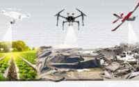
Are Drone Surveys in India the Key to Smarter City Planning?
Drone Surveys: Revolutionizing City Planning in India
The use of drone surveys has brought about a revolution in city planning in India. With their ability to access hard-to-reach areas and capture high-resolution aerial imagery, drones have quickly become an indispensable tool for urban planners and developers. These surveys provide an accurate and comprehensive view of the physical landscape, allowing for more informed decision-making and efficient allocation of resources.
By utilizing drone technology, city planners in India can gather data on key aspects of urban development, such as land use, infrastructure, and environmental factors. This data, in turn, helps them to identify potential challenges and opportunities in the planning process. With the ability to collect data in real-time, drone surveys enable planners to make quick and informed decisions, leading to more efficient and effective city planning strategies. Moreover, the use of drones reduces the need for manual data collection methods, saving time and resources for both planners and developers.
The Role of Drone Surveys in India’s Smart City Initiatives
Drone surveys have emerged as a crucial tool in India’s ambitious smart city initiatives. Continued research and development are expected to enable drones to play an even larger role in urban development strategies. These unmanned aerial vehicles have proven instrumental in assessing and monitoring infrastructure, identifying potential areas of development, and analyzing the impact of urban interventions. By providing a comprehensive and real-time view of the city, drone surveys have paved the way for informed decision-making and efficient resource allocation in India’s smart city projects.
Moreover, the role of drone surveys extends beyond the initial planning stages. As smart cities continue to evolve and grow, drones play a vital role in monitoring and evaluating the effectiveness of implemented strategies. From assessing the success of infrastructure projects to identifying areas requiring maintenance or upgrades, drones provide valuable insights that enable authorities to make data-driven decisions. Additionally, the use of drones in ongoing city planning ensures that development initiatives remain aligned with the evolving needs of the citizens, promoting sustainable growth and improved quality of life.
Exploring the Benefits of Drone Surveys for City Planning in India
Drone surveys have emerged as a game-changer in city planning initiatives across India, offering a multitude of benefits to urban development strategies. Firstly, the use of drones allows for a more comprehensive and accurate data collection process. By capturing high-resolution aerial images and videos, drones provide planners with an enhanced understanding of the existing cityscape, including infrastructure, land use patterns, and population densities. This valuable information helps decision-makers make informed choices when designing and implementing urban development projects.
Moreover, the efficiency of drone surveys cannot be overstated. Traditional methods of data gathering, such as manual surveys or satellite imagery, often require significant time and resources. However, drones can rapidly cover large areas and collect data in a fraction of the time. This increased efficiency not only speeds up the city planning process but also reduces costs, making it a cost-effective solution for local government bodies. Additionally, drones can access remote or hazardous areas that may be difficult for surveyors to reach, ensuring a more comprehensive understanding of the city’s infrastructure and needs.
Overall, drone surveys have proven to be a valuable tool in the city planning process in India. With their ability to provide accurate, extensive, and cost-effective data, drones are revolutionizing the way urban development strategies are conceptualized and implemented. As we delve deeper into this topic, it is essential to explore the challenges and limitations of integrating drone surveys into India’s city planning projects to ensure a smooth and effective transition towards a smarter, technology-driven urban landscape.
The Challenges and Limitations of Implementing Drone Surveys in India
One of the main challenges of implementing drone surveys in India is the regulatory framework. Currently, the rules and regulations surrounding the use of drones in the country are quite strict. There are restrictions on where drones can be flown, the maximum altitude they can reach, and even the size and weight of the drone itself. These regulations can make it difficult for city planners and surveyors to fully utilize the capabilities of drones in their work.
Another limitation is the cost of acquiring and maintaining drone technology. Drones can be quite expensive, especially those equipped with high-quality cameras and sensors needed for accurate surveying. Additionally, regular maintenance and software updates are required to ensure that the drones continue to perform optimally. These costs can add up, especially for smaller cities and towns with limited budgets for urban planning projects.
Overall, while drone surveys have the potential to revolutionize city planning in India, there are still challenges and limitations that need to be addressed. Streamlining the regulatory framework and finding cost-effective solutions could pave the way for wider implementation of drones in urban development projects across the country.
How Drone Surveys Enhance Accuracy and Efficiency in Urban Planning
Drone surveys have emerged as a game-changer in the field of urban planning, offering unprecedented levels of accuracy and efficiency. Traditional methods of data collection, such as land surveys and satellite imagery, often fall short of capturing the detailed information required for comprehensive urban planning. Drones, on the other hand, can capture high-resolution aerial images and collect data with pinpoint accuracy, providing planners with an invaluable resource for decision-making.
By eliminating the need for manual measurements and expensive equipment, drone surveys significantly reduce the time and cost associated with data collection in urban planning projects. Drones can cover larger areas in a fraction of the time it would take using traditional methods, allowing planners to obtain up-to-date information about land cover, infrastructure, and even environmental factors. This efficiency translates into faster project timelines and more informed decision-making processes, enabling cities to adapt and respond to changing urban dynamics with greater agility. Furthermore, the accuracy of drone surveys ensures that planners have precise and reliable data at their disposal, enabling them to make well-informed decisions regarding land use, zoning, and infrastructure development.
The Role of Drone Survey Companies in India’s City Planning Projects
Drone survey companies play a crucial role in India’s city planning projects. Their expertise in capturing high-resolution aerial images and data using unmanned aerial vehicles (UAVs) provides valuable insights for urban development. Skilled professionals employed by these companies operate drones, analyze data, and generate accurate and detailed reports with expertise.
One of the primary contributions of drone survey companies is their ability to collect data efficiently and rapidly. Traditional methods of data collection can take weeks or even months, whereas drone surveys can be completed in a matter of days. This not only saves time but also reduces costs associated with manual labor and fieldwork. By utilizing drones, survey companies can cover large areas quickly, providing planners with an extensive range of data to inform their decisions. This data includes topographical information, land use patterns, infrastructure conditions, and other vital factors necessary for effective city planning.
Case Studies: Successful Implementation of Drone Surveys in Indian Cities
In recent years, drone surveys have emerged as a game-changer for city planning in India. Several case studies have highlighted the successful implementation of these surveys in various Indian cities, showcasing the immense benefits they bring to the table. One such case study is the city of Jaipur, where drone surveys have revolutionized the mapping and analysis of urban landscapes.
By utilizing drones for surveys, the city planners in Jaipur were able to gather highly accurate and detailed data about the city’s topography, land use patterns, and infrastructure. This enabled them to identify potential areas for development, identify existing infrastructural gaps, and make informed decisions about urban design and land allocation. The use of drones not only expedited the survey process but also significantly reduced costs and resources that would have been involved in traditional survey methods. This case study serves as a testament to the power of drone surveys in enabling efficient and effective city planning.
- Surveys have revolutionized the mapping and analysis of urban landscapes in Jaipur, India.
- Drones gathered highly accurate and detailed data about topography, land use patterns, and infrastructure.
- Stakeholders identified potential areas for development, pinpointed existing infrastructural gaps, and made informed decisions about urban design and land allocation.
- The use of drones expedited the survey process and significantly reduced costs compared to traditional survey methods.
Ensuring Data Privacy and Security in Drone Surveys for City Planning
In the age of technological advancements, the use of drone surveys for city planning in India brings with it the need to ensure data privacy and security. As drone technology becomes increasingly integrated into urban development strategies, it is essential to implement robust measures to protect sensitive information and prevent unauthorized access.
One of the primary concerns when it comes to data privacy and security is the risk of data breaches. The data collected during drone surveys can include detailed information about urban infrastructure, land use, and even personal information of residents. Therefore, it is crucial to establish stringent protocols and secure storage systems to safeguard this valuable and sensitive data. Additionally, stakeholders should implement strict access controls and encryption techniques to prevent any unauthorized access or tampering of the data throughout its lifecycle. By prioritizing data privacy and security in drone surveys, city planning initiatives in India can confidently leverage the benefits of this technology while ensuring the protection of sensitive information.
Integrating Drone Survey Data into Urban Development Strategies in India
As cities in India embrace the latest advancements in technology, the integration of drone survey data into urban development strategies has become a crucial component. By utilizing drones for surveying purposes, city planners can obtain accurate and detailed information about the existing infrastructure, land topography, and other relevant factors. Various cities across India can analyze and incorporate this data into their urban development strategies, leading to improved efficiency and effectiveness in planning and execution.
One of the primary advantages of integrating drone survey data into urban development strategies is the enhanced accuracy it offers. Traditional surveying methods can be time-consuming and prone to human error, leading to inaccuracies in the collected data. However, drones equipped with advanced sensors and imaging technology are capable of capturing precise and high-resolution data, leaving little room for errors. Stakeholders can utilize this accurate data to make informed decisions regarding the design and implementation of urban development projects, resulting in more efficient resource allocation and optimal land use.
Future Prospects: Advancements and Innovations in Drone Surveys for City Planning in India
As technology continues to evolve at a rapid pace, advancements and innovations in drone surveys are likely to shape the future of city planning in India. By leveraging the multitude of benefits that drones offer, city planners and developers potentially revolutionize the way urban landscapes are designed and managed. These advancements have the potential to enhance the accuracy and efficiency of data collection, providing valuable insights into various aspects of urban development.
One of the major innovations in drone surveys is the use of artificial intelligence (AI) and machine learning algorithms. By leveraging AI, drones can automate the analysis of large amounts of data collected during surveys. This not only saves time and resources but also improves the accuracy of the analysis. Moreover, the integration of advanced sensors and imaging technology allows drones to capture high-resolution images and 3D models of cities, enabling planners to visualize and simulate different scenarios for better decision-making. Additionally, the development of autonomous drones capable of navigating complex urban environments opens up new possibilities for collecting data in areas that are otherwise difficult to access.
The prospects of advancements and innovations in drone surveys for city planning in India are promising. Continued research and development are expected to enable drones to play an even larger role in urban development strategies. However, it is crucial to address the challenges and limitations associated with the implementation of drone surveys, such as privacy and security concerns, regulatory frameworks, and public acceptance. By overcoming these obstacles, India can harness the full potential of drone surveys to create smart cities that are sustainable, efficient, and inclusive.
How are drone surveys revolutionizing city planning in India?
Drone surveys are revolutionizing city planning in India by providing high-resolution aerial data usable for accurately mapping, monitoring, and analyzing urban areas. They offer a cost-effective and efficient solution compared to traditional surveying methods.
What role do drone surveys play in India’s smart city initiatives?
Drone surveys play a crucial role in India’s smart city initiatives by providing real-time data on infrastructure, land use, and environmental factors. This data is essential for making informed decisions and implementing smart solutions for sustainable urban development.
What are the benefits of using drone surveys for city planning in India?
The benefits of using drone surveys for city planning in India include improved accuracy and efficiency, reduced costs and time, enhanced safety for surveyors, access to hard-to-reach areas, and the ability to capture comprehensive aerial views of the entire city.
What are the challenges and limitations of implementing drone surveys in India?
Some challenges and limitations of implementing drone surveys in India include regulatory restrictions, airspace management, public acceptance, privacy concerns, technical issues such as battery life and connectivity, and the need for skilled operators and data analysts.
How do drone surveys enhance accuracy and efficiency in urban planning?
Drone surveys enhance accuracy and efficiency in urban planning by providing high-resolution imagery, 3D mapping capabilities, and advanced data analysis tools. This allows planners to make more precise measurements, identify patterns and trends, and optimize resource allocation.
What is the role of drone survey companies in India’s city planning projects?
Drone survey companies play a vital role in India’s city planning projects by offering specialized expertise, advanced technology, and professional services for conducting aerial surveys, data processing, and analysis. They collaborate with urban planners and government agencies to ensure accurate and reliable survey data.
Can you provide case studies of the successful implementation of drone surveys in Indian cities?
Yes, there have been successful implementations of drone surveys in Indian cities. For example, in Bengaluru, drone surveys were used to map and assess the city’s slums, enabling targeted interventions for infrastructure development. In Pune, drone surveys helped in monitoring illegal construction activities and ensuring compliance with building regulations.
How are data privacy and security ensured in drone surveys for city planning?
Authorized personnel ensure data privacy and security in drone surveys for city planning by strictly adhering to privacy laws, encrypting sensitive data, employing secure storage and transmission protocols, and restricting access. Additionally, they take measures to anonymize personal information and protect data from unauthorized use or disclosure.
How can drone survey data be integrated into urban development strategies in India?
Integrating drone survey data into urban development strategies in India involves incorporating it into Geographic Information System (GIS) platforms, creating digital twin models of cities, utilizing it for scenario planning and simulations, and sharing it with relevant stakeholders for evidence-based decision-making.
What future advancements and innovations can we expect in drone surveys for city planning in India?
In the future, advancements and innovations in drone surveys for city planning in India may include the use of artificial intelligence and machine learning algorithms for automated data analysis, the development of more advanced sensors and imaging technologies, improved battery life and flight endurance, and the integration of drones with other emerging technologies like 5G and Internet of Things (IoT).


