LIDAR SURVEY
Lidar Services: Atom Aviation is providing Lidar mapping services for government and commercial Area users for over 5 years. Our professional staff is dedicated to enhancing our Lidar processes and production centers to deliver the highest quality products at a competitive price. With the Stereo Lidar technique, you can get an accuracy of up to 5-10 cm for Drone capturing data and approx. accuracy of up to 2 meters for Satellite Imagery ortho. This is very important for doing an accurate lidar Survey.
Atom’s knowledge of advanced lidar environments and geospatial applications enables us to provide support at all stages of the digital LIDAR surface process. Atom has the world’s most advanced Microstation PowerDraft software.
With the help of lidar techniques, you can achieve high accuracy in getting the elevation of bare earth. It is the most important aspect of the construction industry whether road or rail needs to be built, this is very crucial.
The Lidar technique is an important aspect of the following fields:
- Road & Rail route planning for cutting and filling.
- Field location survey.
- Residential area.
- Airport Area.
- Green Fields area.
Light detection and ranging (lidar) is a remote sensing technology used to acquire elevation data about the Earth’s surface. A lidar system consisted of three main components: the laser ranging system, Global Positioning System (GPS), and Inertial Measurement Unit (IMU).
General description
Lidar uses ultraviolet, visible, or near-infrared light to image objects. It can target a wide range of materials, including non-metallic objects, rocks, rain, chemical compounds, aerosols, clouds, and even single molecules A narrow laser beam can map physical features with very high resolutions; for example, an aircraft can map terrain at 30-centimeter (12 in) resolution or better.

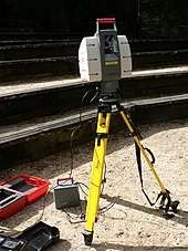
This LIDAR may be used to scan buildings, rock formations, etc., to produce a 3-D model. The LIDAR can aim its laser beam in a wide range: its head rotates horizontally; a mirror tilts vertically. The laser beam is used to measure the distance to the first object on its path.

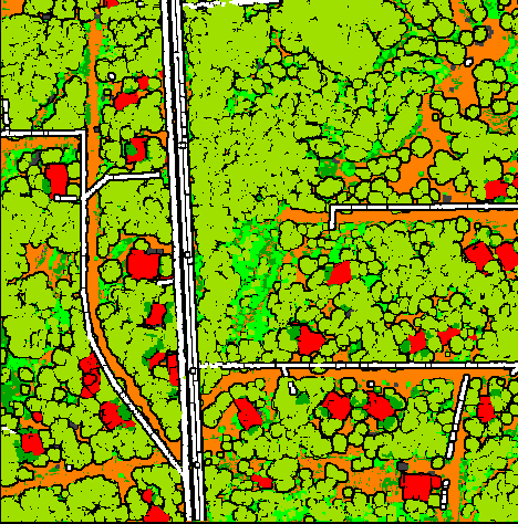
Description Using Lidar Classification Point
- Low Point
- Ground
- Low Vegetation
- Medium Vegetation
- High Vegetation
- Building
- Water Bodies
- High-tension tower
- Wire
- Fence
- Terrain
- Orthomosaic
- Digital Elevation Model
- Digital Terrain Model
- Digital Surface Model
- Contour
- Plan file
Contact Us
Registered address:
- E-523, Ramphal Chowk, Dwarka Sec 7, New Delhi 110075
- +91- 9654450079
- contact@atomaviation.com

