How Drone Surveys Revolutionize India’s Construction Industry?
Unleashing the Power of Aerial Insights

Introduction
The world is in the throes of an infrastructure revolution, and at the forefront of this transformation stands Atom Aviation. Armed with cutting-edge drone technology, Atom Aviation is reshaping the way we plan, execute, and monitor infrastructure projects all over India’s Construction Industry with drone surveys. In a landscape where roads, railways, bridges, and critical assets are rapidly taking shape, the need for accurate and timely data collection has never been more critical.
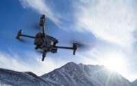
Traditional ground-based survey methods, while reliable, often fall short in terms of speed, cost, and safety—especially in challenging terrains or remote areas. Enter drone surveys, the game-changer that’s rewriting the rules of infrastructure development. These unmanned aerial vehicles (UAVs) armed with high-resolution cameras and sensors offer unparalleled efficiency and precision, transforming the industry.
Benefits of Drone Surveys for Infrastructure Projects
- Enhanced Data Collection: Drone surveys capture high-resolution aerial imagery and data, enabling detailed maps, 3D models, and valuable insights that were previously hard to obtain.
- Improved Efficiency: Drones cover vast areas in a fraction of the time, slashing project timelines and costs.
- Cost-Effectiveness: With fewer manpower requirements and streamlined processes, drone surveys offer a cost-effective alternative.
- Enhanced Safety: No more hazardous on-site work for surveyors—drones take the risk out of inaccessible areas.
- Informed Decision-Making: Accurate data guides decisions from planning to construction and maintenance.
Applications of Drone Surveys in Infrastructure
1. Road and Railway Construction
- Assess terrain, map road alignments, identify obstacles, and monitor progress.
2. Smart City Planning
- Drones aid in urban development, infrastructure layout, and zoning.
3. Industrial Assessments
- Inspect factories, warehouses, and industrial sites efficiently.
4. Pipeline Inspections
- Monitor pipelines for leaks, damage, and maintenance needs.
5. Disaster Management
- Rapid assessment of disaster-affected areas for relief efforts.
Real-World Examples
- Mumbai-Ahmedabad Bullet Train Project:
- Drone surveys mapped the high-speed rail corridor, identified obstacles, and assessed environmental impacts.
- NHAI’s Monthly Drone Surveys:
- NHAI leverages drone technology for safer highways, optimized resource allocation, and reduced maintenance costs.
Atom Aviation: Pioneering Progress
At Atom Aviation, we’re not just flying drones; we’re shaping India’s infrastructure future. Our expertise spans power line monitoring, road inspections, mine surveying, and more. From the purchase of land to project closeout, drones are our eyes in the sky, ensuring progress with precision.
Now, let’s sprinkle some captivating headings throughout our piece. These serve as signposts, guiding readers through our aerial journey:
- “Navigating the Digital Skies: A Brief History of Drone Surveys”: Here, we’ll explore how drones evolved from sci-fi dreams to indispensable tools in the construction sector.
- “Mapping the Unseen: How Drones Create 3D Terrain Models”: Dive into the nitty-gritty of data capture, stitching, and transforming aerial imagery into actionable insights.
- “From Pixels to Progress: Analyzing Drone Data”: Uncover how construction professionals extract valuable information from gigabytes of visual data.
- “Safety First: Ensuring Compliance and Risk Mitigation”: Discuss regulations, privacy concerns, and safety protocols for seamless drone integration.
- “Beyond the Blueprint: Real-Life Success Stories”: Spotlight projects where drones accelerated progress, saved costs, and enhanced decision-making.
Frequently Asked Questions (FAQs)
- Q: Are drone surveys legal in India?
- A: Yes, the Directorate General of Civil Aviation (DGCA) permits drone operations in India. However, compliance with regulations, airspace restrictions, and safety guidelines is crucial.
- Q: How accurate are drone-generated 3D models?
- A: Drone-generated 3D models boast sub-centimeter accuracy, making them invaluable for precise measurements, volume calculations, and site analysis.
- Q: Can drones withstand extreme weather conditions?
- A: Modern drones are rugged and weather-resistant. However, adverse conditions like heavy rain or strong winds can affect flight stability.
In Conclusion
As we soar into the future, Atom Aviation remains committed to harnessing the full potential of drone surveys. From power lines to smart cities, our skies hold endless possibilities.


