Drones Archive
22 Mar 2024
Drone Surveys: The Game Changer for India’s Disaster Management Strategies

Drone Survey: The Game Changer for India’s Disaster Management Strategies Over recent years, drone surveys have revolutionized numerous sectors, significantly impacting India’s approach to disaster management. This advanced technology has equipped agencies with the necessary tools for effective and efficient response during emergencies. This article explores how drone survey has emerged as a game-changer for
21 Mar 2024
Drone Surveys in India: Uncover the Secrets of Historical Sites

Introduction Drones, which were initially developed for military purposes, have witnessed an exponential rise in civil applications, including historical site surveys. India, a country globally renowned for its rich historical heritage, is now tapping into the potential of drone surveys to unveil the undisclosed secrets of its historic sites. These advanced tools are not just
19 Mar 2024
Drone Survey Company in India: Redefining Surveying and Mapping

Introduction to Drone Survey Company in India The advent of drones, fondly known as Unmanned Aerial Vehicles (UAVs). It has brought forth a radical transformation in several industry sectors, with surveying and mapping witnessing the most profound impact. Drone survey companies in India are witnessing substantial growth, offering a wide array of services such as
19 Mar 2024
How Drone Surveys Revolutionize India’s Construction Industry?

Unleashing the Power of Aerial Insights Introduction The world is in the throes of an infrastructure revolution, and at the forefront of this transformation stands Atom Aviation. Armed with cutting-edge drone technology, Atom Aviation is reshaping the way we plan, execute, and monitor infrastructure projects all over India’s Construction Industry with drone surveys. In a landscape
15 Mar 2024
Which type of drone is preferred to conduct an aerial survey of large areas?
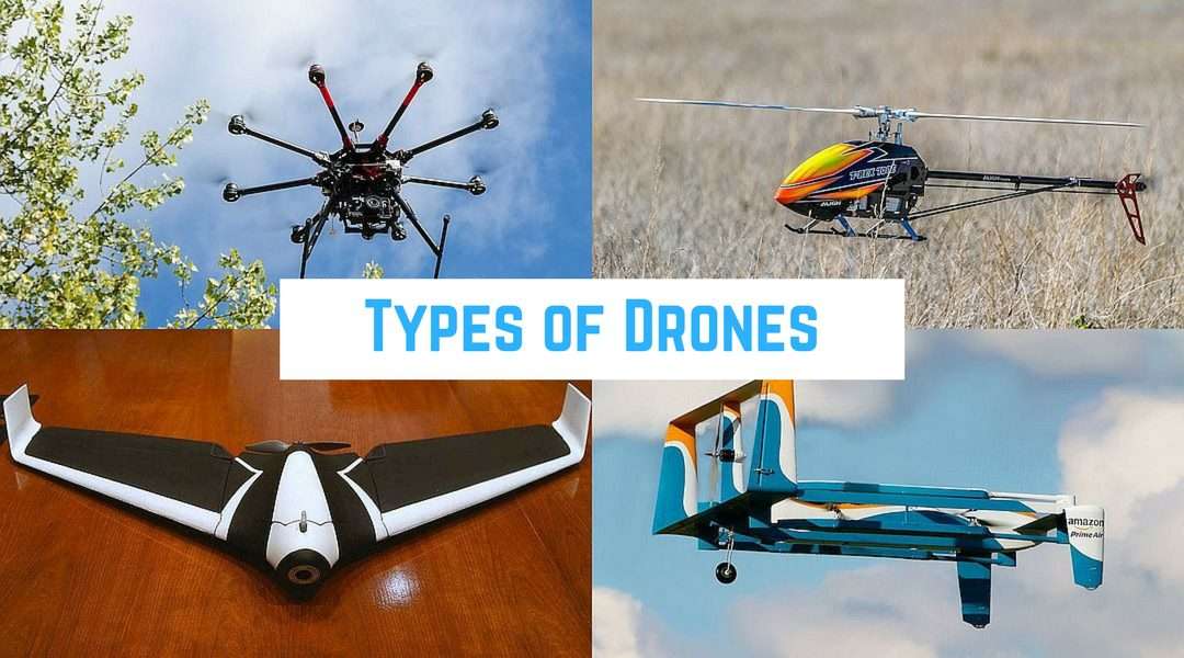
In the realm of aerial surveys, drones have emerged as indispensable tools, revolutionizing the way we gather data over vast expanses of land. Whether for environmental monitoring, construction site mapping, or agricultural assessment, selecting the right type of drone is paramount for achieving accurate results efficiently. Among the myriad options available, certain drone types stand
15 Feb 2024
Are Drone Surveys in India the Key to Smarter City Planning?

Drone Surveys: Revolutionizing City Planning in India The use of drone surveys has brought about a revolution in city planning in India. With their ability to access hard-to-reach areas and capture high-resolution aerial imagery, drones have quickly become an indispensable tool for urban planners and developers. These surveys provide an accurate and comprehensive view of
18 Jan 2024
Atom Aviation Soars High with Precision in Topographical Survey for Bullet Train Project in Gujarat

Atom Aviation the Delhi-based Company that is India’s leading AI and Drone analytics played a vital role in the success of the Mumbai-Ahmedabad Bullet Train Project by conducting the Topographical Survey in Gujarat. Using state-of-the-art technology, including advanced drones, Atom Aviation carried out a detailed survey, gathering important data for the project.
17 Jan 2024
This company did Topographical Survey of Prestigious Ram Mandir, Ayodhya
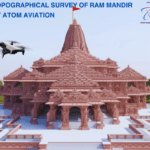
This company did Topographical Survey of Prestigious Ram Mandir, Ayodhya Ayodhya, Uttar Pradesh – January 17, 2024 – The Delhi-based company which is India’s leading AI and Drone analytics company did the topographical survey of India’s most prestigious project i.e. Ram Mandir Project which is located at Ayodhya. Topographical Survey of Ram Mandir by Atom
16 Jan 2024
Revolutionizing Land Surveying: What are the Advantages of Drone Survey in India?

Drones have rapidly gained popularity and become a game-changer in various industries, including land surveying. In India, the utilization of drone technology has been on the rise, revolutionizing traditional surveying methods. This blog post aims to explore the advantages of drone survey in India, shedding light on their enhanced precision, increased efficiency, enhanced safety,
03 Jan 2024
Optimizing Your Aerial Survey and Mapping with Atom Aviation: Premier Drone Survey Services in India

Introduction Drone survey companies in India play a crucial role in the industry by providing professional drone survey and mapping services. These services are essential for various sectors such as transportation, renewable energy, mining, utilities, infrastructure, agriculture, and oil/gas. By utilizing drones for their surveying and mapping needs, businesses can leverage several key benefits. Here’s
- 1
- 2
