Drones Archive
30 Dec 2023
Drone Survey Company in India : How we Help You with Your Drone Survey and Mapping Needs
Are you looking for a drone survey company in India that can provide you with high-quality drone survey and mapping services for your projects? Do you want to know how drone surveys and mapping can benefit your business and industry? Do you want to learn more about the technology and process involved in drone survey
26 Dec 2023
Unlocking the Potential: A Comprehensive Guide to Drone Surveying and Mapping
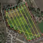
Drones have revolutionized the way we approach surveying and mapping, unlocking a world of possibilities and efficiency. In this comprehensive guide, we will take you on a journey to discover the potential of drone surveying and mapping and how it can benefit various industries. From construction sites to agricultural landscapes, drones offer a bird’s-eye view
28 Nov 2023
How Drone Surveys Empower Infrastructure Development in India?
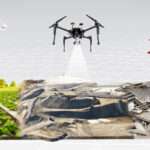
The world is undergoing a period of unprecedented infrastructure development, and Atom Aviation stands at the forefront of this transformation using drone surveys. As the country continues to build its roads, railways, bridges, and other critical infrastructure assets, the need for accurate and timely data collection has become more crucial than ever. Traditional ground-based survey
15 Nov 2023
Best Drone Survey Company in India
Are you looking for a reliable and best drone survey company in India? Do you want to get high-quality aerial data for your project? If yes, then you have come to the right place. In this article, we will tell you everything you need to know about drone surveys, their benefits, how to choose a
31 Oct 2023
Railway Projects with UAV Technology
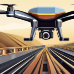
Overview Introduction to UAV technology Unmanned Aerial Vehicles (UAVs), also known as drones, have emerged as a game-changing technology in various industries, including railway projects. These remotely controlled aircraft have the ability to capture high-resolution images, collect data, and perform tasks that were once time-consuming and costly. With their versatility and maneuverability, UAVs have revolutionized the way railway
16 Apr 2022
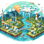
Building a Digital Twin for Germany

The German Federal Agency for Cartography and Geodesy (BKG) is making a computerized twin of Germany that can be utilized to mimic different future situations to satisfactorily address cultural difficulties, for example, the rising utilization of land, rising energy requests and outrageous climate. This advanced copy of Germany will be worked as a clever 3D
22 Mar 2022
DJI M30 Drone :Full Specs & Cost
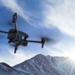
DJI M30 Drone :Full Specs & Cost DJI has launched the Matrice 30, a truly enterprise-class drone with IP55 dust and water resistance that lets it fly in heavy rain, strong wind and even snow conditions. It can fly to altitudes as high as 22,965ft above sea level (with the right propellers) and survive temperatures
- 1
- 2
