LAND SURVEYING AND MAPPING BY DRONE
LAND SURVEYING & MAPPING BY DRONE
Objective of Land surveying and Mapping by Drone is to collect survey data about the Natural and Man-mad features of the land, as well as its Elevation, It helps Architects, Engineers, And Building Contractors to Understand the Elevation Profile accurately. https://www.atomaviation.com/land-use-and-land-cover-mapping/
Surveying & Mapping By Drone provides high-resolution orthomosaics and detailed 3D models of areas where low-quality, outdated or even no data, are available. They thus enable high-accuracy cadastral maps to be produced quickly and easily, even in complex or difficult to access environments. Surveyors can also extract features from the images, such as signs, curbs, road markers, fire hydrants and drains.

Land surveying and mapping by Drone
Process of Land Surveying and Mapping by Drone:
- Area of Interest (AOI) Analysis on Google Earth.
- Ground Points Distributions, Ground control Point(GCP) marking and picking Values.
- Flight Planing for Raw Image Capturing.
- Image Processing.
- Othomosaic & DSM/DEM generation.
- Contour Map Generation.
- GIS Map Creation.
Area of Interest (AOI) Analysis on Google Earth
Analysis of all Features and Elevation profile on google earth for better understanding of Area.
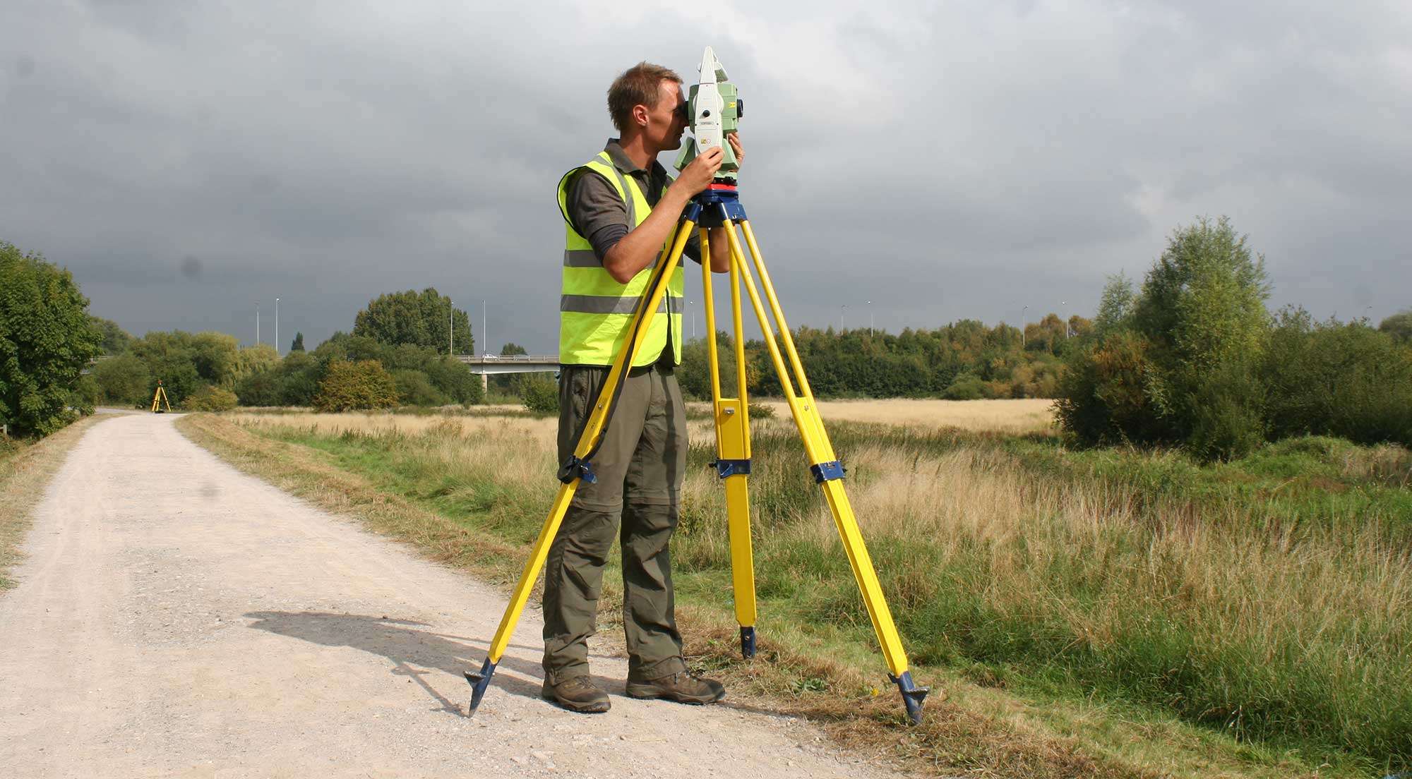
Ground Points Distributions, Ground control Point(GCP) marking and picking Values
Well Distribution of GCP points is very important to get better accuracy. map can be generated with and without GCP points as well.

Land surveying and mapping by Drone
Land surveying and mapping by Drone

Land surveying and mapping by Drone
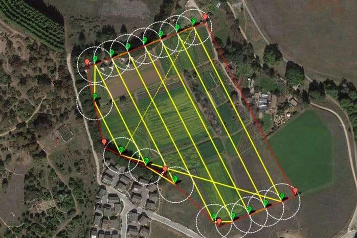
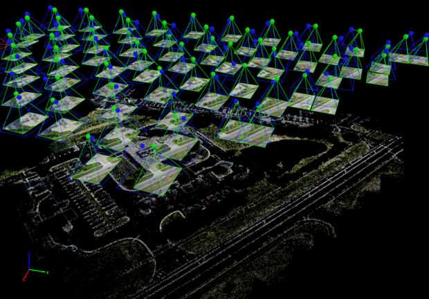
Flight Planing for Raw Image Capturing
Flight Planning done After well understanding of AOI. Planning for Land Survey & Mapping by Drone plays vital role to cover the Entire AOI with proper side over lapping and forward over lapping to get good quality of Map.https://www.atomaviation.com/services/
Land surveying and mapping by Drone
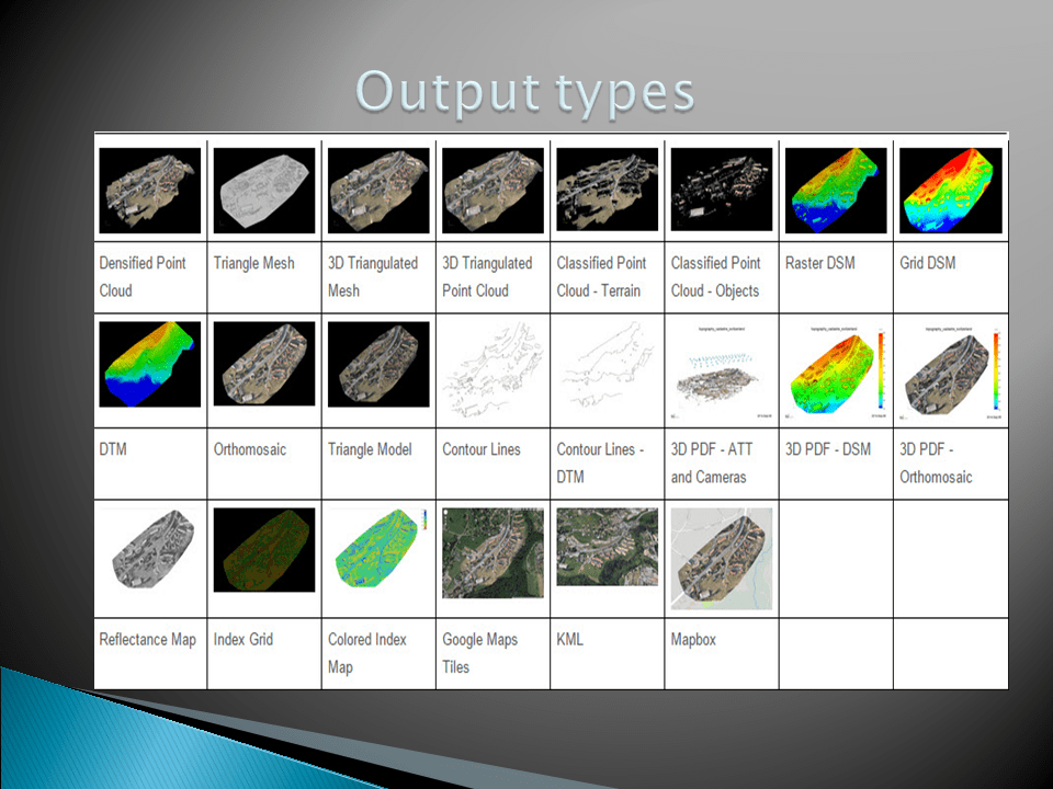
Image Processing
Image Processing includes many sub process to generate all types of Maps.https://www.pix4d.com/product/pix4dmapper-photogrammetry-software
- Image Initialization & Matching Images.

Raw Images
- Ray cloud & Point Cloud Generation
Pointcloud and raycloud
-
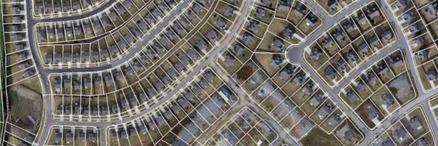
Othomosaic & DSM/DEM generation

Orthomosaic map of surveyed land

All types of Maps

Contour Map
GIS Map Creation
GIS MAP
kindly follow the link to know the Land Surveying & Mapping by Drone https://www.atomaviation.com/land-use-and-land-cover-mapping/